
Design puts Docklands on the map

By Bethany Williams
Docklands’ significant architectural sites are the subject of a new bicycle route map.
Architecture firm Elenberg Fraser have mapped a bicycle route around Docklands, which visits 18 architectural sites in the area.
The bicycle route starts and ends at Southern Cross station on Spencer St. This site was seen as the natural starting point for the Docklands area.
Other sites visited along the route include NewQuay Promenade, Webb Bridge and the Mission to Seafarers building.
Graduate Elenberg Fraser architect Jansen Aui, who worked on the mapping project, said the bicycle route was a way of introducing people to the “eclectic quality of design” in the area that not many are aware of.
“The route will give people an idea of the diversity of design in Docklands,” Mr Aui said.
By following the route on foot or by bike, it is hoped that locals and visitors will gain insight into the variety of design, which can be found in the area.
It is estimated that the route will take around half an hour to cycle and between 45 minutes to an hour to walk.
The map is part of a project called Mapping the ‘Burbs, which featured in last month’s State of Design festival. The project ties in with the festival theme “design that moves”.
Mapping the ‘Burbs is an initiative of the Victorian chapter of the Australian Institute of Architects.
Mapping the ‘Burbs involved nine architectural firms located or with a connection to suburban or regional Victoria designing a cycling tour based around the significant pieces of architecture in their local area.
Other areas mapped in the project include Fitzroy, Kew, South Yarra/Prahan, St Kilda, Beaumaris, Hawthorn, Bendigo and Mornington.
The Docklands bicycle route can be found at http://www.architecture.com.au/emailnews/mapping-the-burbs/docs/map-burbs-docklands.pdf
For further information about Mapping the ‘Burbs see http://www.mappingtheburbs.com
Related Articles
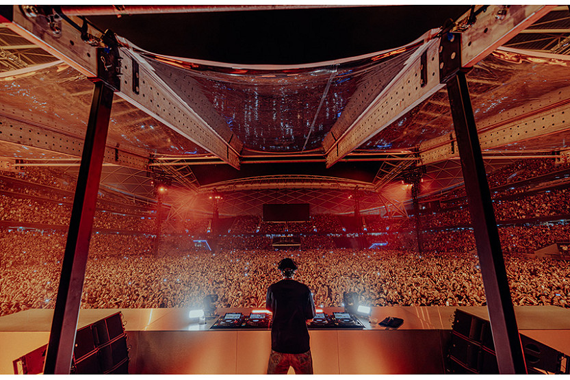
Dom Dolla sellout delivers another boost for Docklands
Docklands is set for another major event boost this September, with Melbourne’s own Dom Dolla selling out Marvel Stadium for what is being billed as one of the biggest electronic music moments in Australian history.
Read More
ATET case circles back as City of Melbourne’s amended defence revives old admissions
The City of Melbourne’s latest pleadings in the $7 million Supreme Court battle over Docklands venue ATET suggest the case has come almost full circle, raising fresh questions about why so much court time was burned in April on a position the council now appears to have largely abandoned.
Read More
New street food and entertainment series to boost Docklands this winter
Docklands’ waterfront will receive another welcome boost this June with the launch of The Street Social, a new seasonal event series bringing food, entertainment, sport and family-friendly activities to Harbour Esplanade.
Read More
New street food and entertainment series to boost Docklands this winter

City of Melbourne chief Alison Leighton to take leave as acting CEO appointed

 Download the Latest Edition