Waterways are a constant presence in the daily life of Docklands
Understanding the history of the waterways of Docklands is very rewarding. What we see now is indeed impressive and unique in Melbourne but the “back-story” of what you see now of today’s waterways warrants attention.
To gain a better understanding of the waterways’ “back-story”, Melbourne Maritime Heritage Network (MMHN) highly recommends a visit to the excellent free exhibition currently at the Old Treasury Building. The exhibition is entitled Yarra- Stories of Melbourne’s River. See oldtreasurybuilding.org.au
The wonderful historical images presented clearly remind us that indeed “Melbourne’s Yarra River looks placid most of the time, but it is a river with a turbulent past”. The images also provide a glimpse into just how important the river has been in the evolution of Melbourne as the major port in the south.
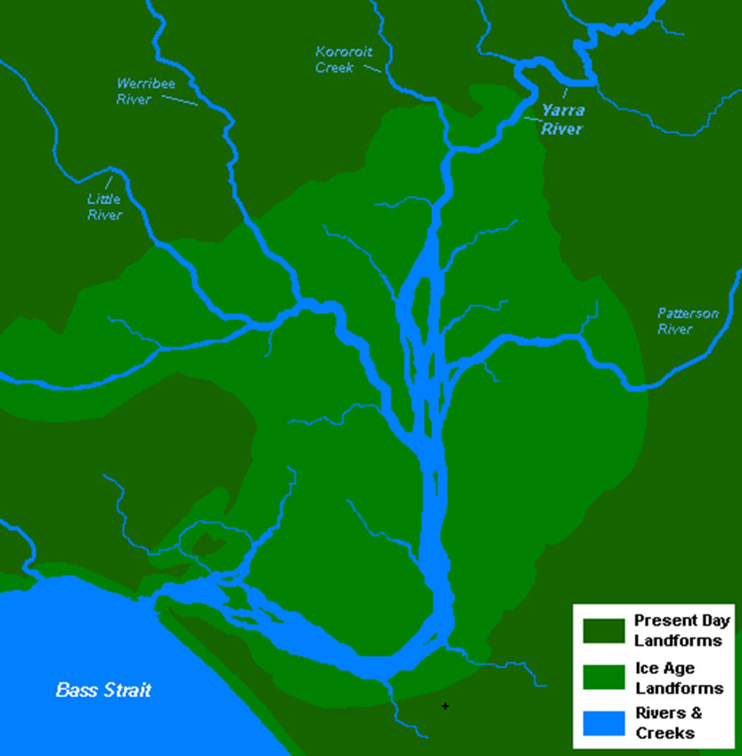
The “back-story” is less well known but equally fascinating. The Yarra River is described as an “ancient watercourse” which “evolved slowly in response to major climate events. Its silt-laden course once meandered through large areas of wetland to meet Port Phillip Bay just below the site of today’s CBD – the end of a 242 km journey from the Great Dividing Range”.
In years of high rainfall, the Yarra burst its banks and spread out over the landscape near Melbourne, filling the wetlands before reaching the sea.
The Birrarung-Yarra River flowed across what we now see as the vast Port Phillip Bay, but which was formerly a wide grassy plain that was a good hunting ground for emu and kangaroo. This plain, a shallow basin, dried out over thousands of years. Speculation is that a sand blockage occurred closing what we know call The Heads. This blockage, coupled with high evaporation rates, led to the creation of the plain inland from the sea. Channels made by the rivers running through the dry plain to the sea are still evident on the sea floor of the bay today.
A core profile collected by drilling into the seabed today reveals the layers of sediment. Then, around 8000 years ago, rising sea levels, the sea broke through the great plain creating Port Phillip Bay and the Yarra estuary. Tides flooding upstream up the river as far as the rocky ledge (see the image) carved out a natural turning basin below the rocky ledge which assisted early shipping turn around to sail downstream into the bay. The Boon Wurrung and Wurundjeri people have many different stories about how their country, including the bay, was formed. Click here to read more.
Now Melbourne’s large and sheltered Port Phillip covers some 930 square kilometres, a 35 times greater area than Sydney Harbour.
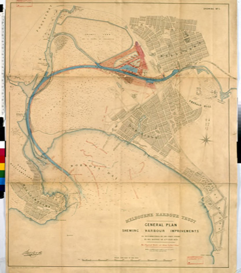
MMHN celebrates and admires our maritime heritage. We recognise the ingenuity and engineering know-how evident in form of the waterways we see today. Nineteenth-century engineers Coode and Brady largely tamed the troublesome flooding and intermittent swamps near the CBD.
They straightened the course of the river to more efficiently enable the growth of maritime trade, which underpinned Melbourne’s prosperity. They cleverly excavated them to so remarkably increase wharf areas in Victoria Harbour. Such changes were not positive for the Indigenous community nor the environment.
Change in our waterways is a constant. What changes are evident? Climate change or council policies? Mindful of these “back-stories” It is interesting to reflect on the current efforts and substantial investment by the City of Melbourne to restore the Birarung-Yarra River and its estuary. The question arises – which “back-story” is the most authentic or legitimate? How far back should we go? •
Related Articles

Shipping Control Tower: questions remain
Until now this significant maritime infrastructure asset, the responsibility of state authority Development Victoria (DV), continues to loom as a degraded bastion of failed vision like the Wheel, Harbour Esplanade and Central Pier.
Read More
Parks Victoria’s litter management under the microsope
People tend to be drawn to live close by to waterways, whether these be rivers, harbours or beaches. The Docklands community is evidence of this universal attraction.
Read More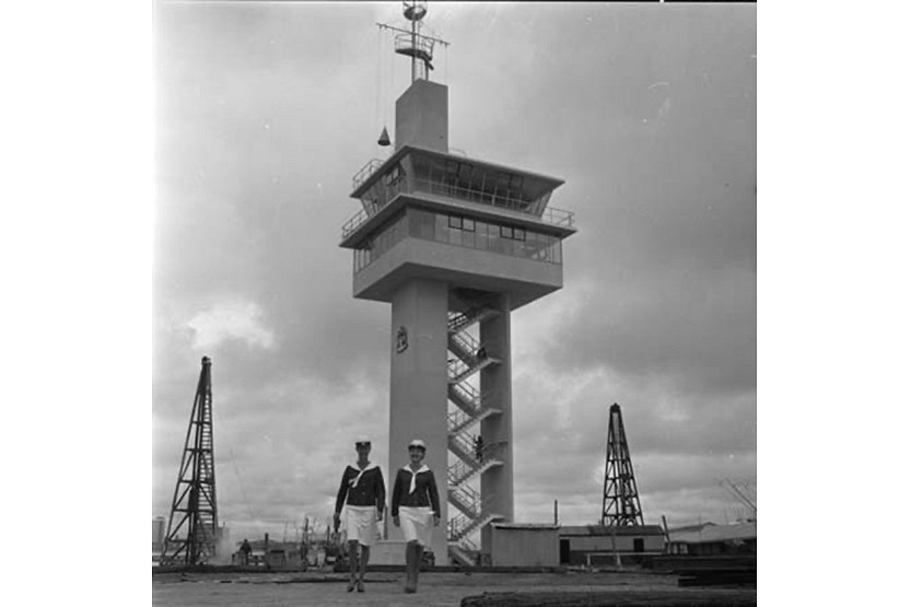
Celebrating Docklands’ maritime heritage in 2024
The Melbourne Maritime Heritage Network (MMHN) looks forward in 2024 to working with the Docklands community to grow public awareness of the precinct’s unique maritime heritage.
Read More
Meet Lucas Guilbert

The inaugural Community3008 meeting
 Download the Latest Edition