
Sky high over the Yarra

By Ashley Smith, Royal Historical Society of Victoria
By the 1920s, Australia was embracing the age of aviation. The England-to-Australia exploits of Keith and Ross Smith were inspiring future pioneers of the sky, while in far western Queensland, a small company known as QANTAS was taking off.
Aircraft also revolutionised the way Melbourne could be photographed as seen with this 1925 image featuring the Flinders St extension and Southbank. On this particular day the photographer would have had to bring their camera on board a plane (that seated two or more men), then brave the high velocity winds, the roaring engine noise, and vertigo to take this picture.
Aerial photography was hardly new: from the mid-19th century airborne photographs were taken from gas balloons and box kites.
However, with World War I forcing the progression of photographic technology for reconnaissance work (particularly in cartography), it was inevitable that these advancements would soon apply to commercial use. By the 1920s, aerial photography was being used for many purposes due to its speed, access to otherwise inaccessible terrain and cost. In cartography, it was assisting in the creation of accurate maps of Victoria. In 1923, surveyor R. McGregor collaborated with a Major G.A.C. Cowper (of Shaw-Ross Aviation Co.) to take an aerial map of Coburg for town planning, while braving 80mph speeds and awkward tilting. The Herald also recognised its benefits in fire prevention, forest preservation and irrigation (January 9, 1922).
While the exact purpose of this photograph is unknown, it does give us a birds-eye view of the ports along the Yarra. At the middle right of frame (where the Exhibition Centre now stands) are two graving docks that were owned by the Duke and Orr Amalgamated Dry Docks Ltd, which had merged from two separate companies in 1910. During this time, both their timber-made dry docks could hold boats up to 6000 tons for repairs, painting and cleaning. The dry one with a ship inside is the Orr dock, which had been in existence since 1878. The longer dock filled with water is Duke’s Dock. Initially built in 1875, after reconstructions in the 1900s it stretched as far as 520 feet. However, on this day it was out of commission due to floods in 1923 when water rushed through two holes at the gate. Despite estimates it would take a year to repair and the erection of a coffer dam, further flooding would sideline it until 1926.
Above the graving docks, one gets a view of the streets of Melbourne, as well as what would become Southbank, in the years when ships were free to sail past Spencer St to the wharves along Flinders St. The diagonal bridge cutting between Princes Bridge and Queens Bridge is Sandridge Bridge. Starting as a wooden bridge in the 1850s, the current incarnation was opened in 1888, carrying a railway that took tourists and civilians from Flinders St to the seaside at St. Kilda and Port Melbourne. Further up Southbank, are the factories of Allen’s sweets and J. P. Summit and Son’s ice cream, which created confections that generations of children enjoyed.
Finally, there is the left bank below the Spencer St viaduct, the Flinders St extension. During the early 1920s it had a reputation for being a dusty thoroughfare, which was prone to become muddy in wet weather. Sometimes the mud got so bad that according to The Herald (July 19, 1923) it was “almost impossible to cross over without sinking over one’s shoe tops in the ooze.” On the far left, is a brick wall dividing the goods yards of Spencer Street Station from the road. Known as the “Wailing Wall”, it was common to see men rejected from the nearby stevedores office standing along the structure as they waited for another chance to earn their daily bread at the docks. At the bottom right of Flinders St is the Victorian Mission to Seamen, now known as the Mission to Seafarers. Designed by architect Walter Butler and constructed in 1916, the church and its domed-shaped gymnasium assisted in the moral wellbeing of wharf workers and sailors (especially those at the nearby Sailors’ home, seen top right of the neighbouring Siddeley St). Along the bank of the extension are various sheds, where steamships from various companies would pick up cargo and deliver interstate or overseas.
As we know, there have been huge changes to this part of Melbourne in the ensuing 95 years. By the Great Depression a bridge linking Spencer St and South Melbourne would block off large ships from Queens Wharf. The Depression would claim Orr’s Dock in 1932, while Duke’s Dock would soldier on until the inability to meet demands of larger ships saw it end business in 1975. Today it’s the home of the Polly Woodside. The Sandridge Bridge carried its last train in 1987 and was redeveloped into a walkway with monuments to our multicultural history. Even the factories and sheds that lined the banks are gone for casinos, shopping complexes and hotels.
But the more things change the more they stay the same – the Mission to Seafarers is still in use as a heritage site, and the Wailing Wall (give or take some modifications) still lines Flinders St beyond the viaduct. Then there’s the Yarra, which continues to snake through the city to this very day.
And if you see a hot air balloon fly over the river, it’s a sure bet that a tourist will take a snap of this view once more.
Pam the Bird suspect arrested after Bolte Bridge standoff
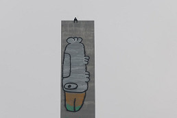
Police in standoff with Bolte Bridge graffiti trespasser

 Download the Latest Edition