
Harbour Esplanade to feature in 220km Birrarung walk
A long-term plan for a 220km “whole-of-river” walking trail along the Yarra, or Birrarung, will take walkers through Docklands and along Harbour Esplanade as part of a major new route connecting the river’s lower reaches to the Upper Yarra Reservoir.
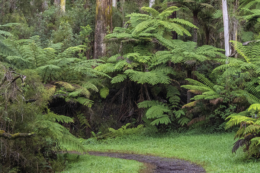
The Birrarung Valley Walk, expected to open in 2029, will run from Williamstown to the forested Yarra Ranges, linking existing riverside paths, cultural sites, parks, wetlands and major city landmarks.
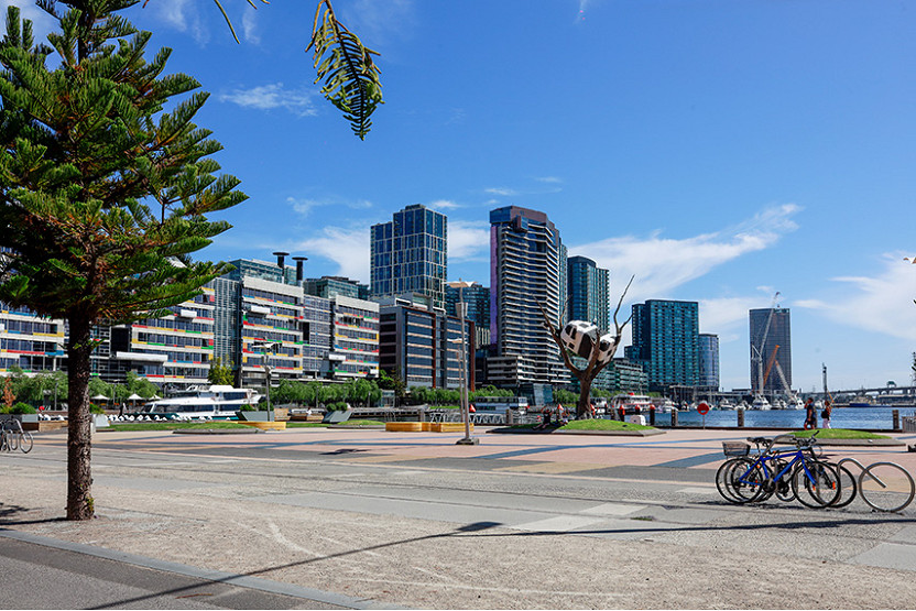
In the city, the route will include areas west of Docklands, taking walkers along Harbour Esplanade, before heading towards Federation Square and Birrarung Marr to form an important part of the walk’s urban waterfront experience.
But rather than simply tracing the river as it appears today, the western city section will also take walkers through the original Yarra corridor west of Docklands, reflecting the fact that the river’s course was dramatically altered after colonisation.
Birrarung Walk Inc. executive director Nichola Lefroy said the section that appears to stray from the current river corridor from the current Yarra alignment was intentional.
The route heads north-west along the Maribyrnong River because the confluence of the Yarra and Maribyrnong once sat much higher than it does today, before the Birrarung was straightened as part of colonial-era engineering works.
The area between the present river and the walk’s alignment was once swampland, rich with bird and animal life.
By taking walkers through that landscape, the walk will be able to tell a deeper story about how the river was changed, how wetlands were filled, and how the city’s western waterfront was reshaped over time.
It also avoids reliance on the punt beneath the West Gate Bridge between Spotswood and Westgate Park, which operates only during peak periods.
The proposed walk will feature major destinations, including Herring Island, Abbotsford Convent, Heide Museum of Modern Art, Warrandyte and Mount Lofty, before finishing near the river’s source in the Yarra Ranges.
As with Victoria’s Great South West Walk and Grampians Peaks Trail, walkers could choose to complete the route over several weeks or tackle individual stages.
Unlike more remote walks, however, the Birrarung Valley Walk is expected to offer accommodation options at the end of each stage.
According to Birrarung Walk Inc., the project is being developed in collaboration with Traditional Owners, state entities and local governments along the river, and in deep partnership with the Wurundjeri Woi-wurrung Cultural Heritage Aboriginal Corporation.
A key part of the project will be a companion app providing separate streams of environmental, First Nations and post-colonial stories. It will also allow walkers to report dumped rubbish or environmental issues.
While about 80 per cent of the 220km trail already exists as publicly accessible pathways, new or upgraded sections will be needed beyond Warrandyte.
In the CBD and Docklands sections, Ms Lefroy said the major work now was not so much building new paths, but working with land managers and Traditional Owners to gather and curate the stories that will be told along the route.
City of Melbourne Deputy Lord Mayor Roshena Campbell said the project would change the way people experienced Melbourne.
“It’s a privilege for the City of Melbourne to work alongside Traditional Owners, our council peers and land managers to shape a world-class experience for Melburnians and visitors,” Cr Campbell said.
It’s an historic project and a bold vision that will change the way we experience our city.
Environment portfolio lead Cr Davydd Griffiths said the walk offered “an extraordinary opportunity” to connect people to the living river corridor.
“Whether it’s a short walk through the city or the full 220km journey, this walk will offer a chance to better understand the environmental, cultural and historical significance of the Birrarung,” he said.
Ms Lefroy said the late Dr Maudie Palmer AO, founding director of what is now Heide Museum of Modern Art, had been the driving force behind the idea.
The vision gathered momentum during the COVID years and gained support from Wurundjeri Woi-wurrung and Bunurong Traditional Owners in 2023. Formal planning with local governments and public land managers began in 2024.
For Docklands, the route offers a chance to place Harbour Esplanade within a much broader story: not only as a modern waterfront spine, but as part of a changed river landscape shaped by wetlands, industry, engineering and renewal.
Melbourne Water manager Matthew Daley said the authority was working with steering committee members on the next stages of planning to help define access routes, clear pathways and appropriate signage, while ensuring the proposal protected the river and drinking water supply. •
Related Articles
Stopping rubbish entering Victoria Harbour
While battling environment ministers and government departments, it can be easy to lose sight of the issue at hand.
Read More
Preventing litter from entering Victoria Harbour
Incremental steps have been achieved since my May update, although the results have again not been as prompt as I would have liked.
Read More
MV Steve Irwin returns to Docklands as Ship 4 Good brings new life to Victoria Harbour
One of the world’s most recognisable conservation vessels has returned to Docklands, with the famous MV Steve Irwin now berthed in Victoria Harbour for a new chapter focused on community access, education and activation
Read More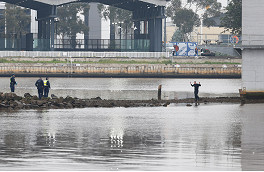
Pam the Bird suspect arrested after Bolte Bridge standoff
Police in standoff with Bolte Bridge graffiti trespasser

 Download the Latest Edition