
Framework to shape Fishermans Bend’s identity heads to council

A new placenaming framework designed to guide how streets, parks and landmarks are named across Fishermans Bend will go before City of Melbourne councillors at the March 3 Future Melbourne Committee meeting.
The draft framework, prepared in partnership with Development Victoria and the Victorian Government, is intended to bring structure and consistency to naming decisions across the council’s share of Australia’s largest urban renewal area, which spans parts the future Employment Precinct and the Lorimer precinct and is forecast to accommodate tens of thousands of residents and jobs in coming decades.
The City of Port Phillip is the local government responsible for the southern side of Fishermans Bend, taking in the precincts of Wirraway, Sandridge and Montague.
According to the City of Melbourne report, the framework establishes a clear thematic approach to future names, aiming to reflect the area’s industrial and maritime heritage, Aboriginal cultural history, and future-facing identity as an innovation and employment hub.
Fishermans Bend has long been associated with shipbuilding, manufacturing and aviation, and more recently has been earmarked as a centre for advanced industries, education and research. The proposed framework seeks to ensure that this layered history is embedded in the suburb’s evolving geography, rather than leaving naming decisions to ad hoc proposals.
Under the framework, themes would guide the naming of new roads, laneways, public spaces and potentially major civic assets as redevelopment progresses. This includes recognising significant individuals, historic industries and events connected to the area, as well as ensuring alignment with state naming policies and Indigenous naming principles.
The report to councillors notes that placenames are not merely administrative tools but play a key role in shaping local identity and community connection. As Fishermans Bend transforms from former industrial land into higher-density neighbourhoods, the way its streets and public spaces are named will influence how residents and visitors understand its story.
The framework also emphasises engagement with Traditional Owners in identifying opportunities for Aboriginal language names and cultural recognition. This reflects a broader shift across Melbourne toward dual naming and greater visibility of First Nations history in the public realm.
Fishermans Bend’s redevelopment has not been without controversy. Planning controls, infrastructure delivery and community facilities have all been subjects of debate over the past decade. Against that backdrop, the placenaming framework represents a relatively modest but symbolically significant step in defining the character of the emerging precinct.
The committee report indicates that, if endorsed, the framework will guide future naming proposals but does not itself assign specific names at this stage. Individual naming decisions would still be subject to the usual statutory processes, including consultation and approval under Geographic Names Victoria requirements.
With major infrastructure such as the future Fishermans Bend tram connection and new schools in planning or under construction, the need for a coherent naming strategy is becoming more pressing. Large-scale urban renewal areas can quickly become disjointed if naming lacks a clear rationale, particularly when multiple developers and government agencies are involved.
By setting agreed themes early, the council and the state aim to avoid duplication, confusion or names that fail to resonate with the area’s history and aspirations.
Related Articles
Tram bridge to E-Gate still possible despite West Gate Tunnel fears
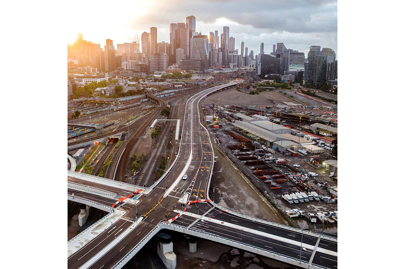
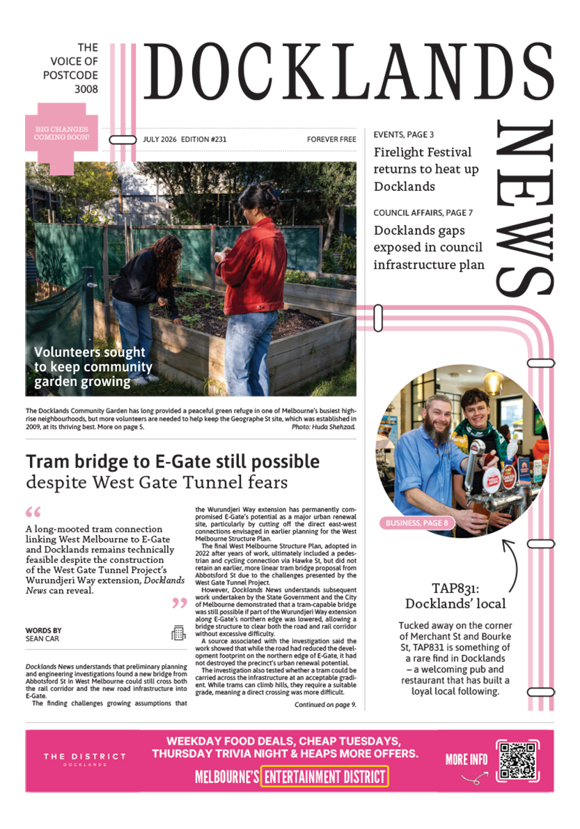
A long-mooted tram connection linking West Melbourne to E-Gate and Docklands remains technically feasible despite the construction of the West Gate Tunnel Project’s Wurundjeri Way extension, Docklands News can reveal.
Read More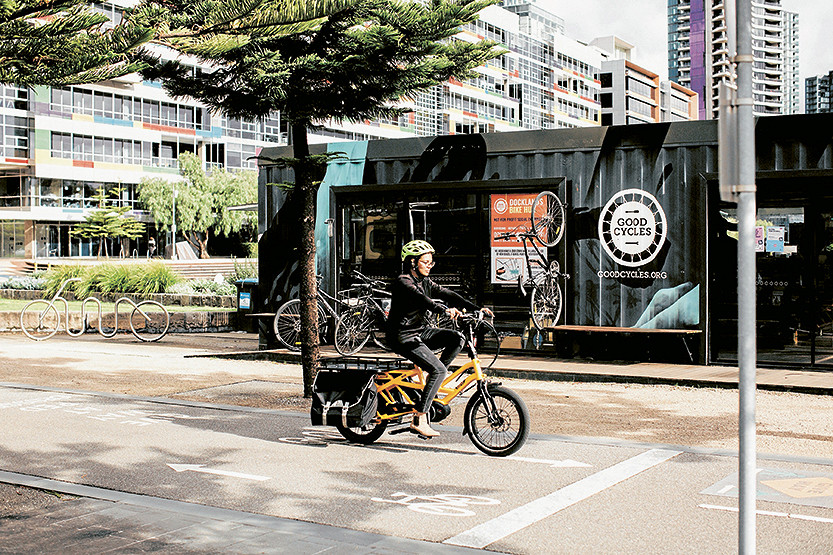
Good Cycles departs Docklands bike hub after decade on Harbour Esplanade
The Good Cycles bike hub on Harbour Esplanade has closed after almost a decade in Docklands, opening up a new opportunity for the City of Melbourne and Development Victoria to rethink one of the waterfront’s most visible small-scale activation sites.
Read More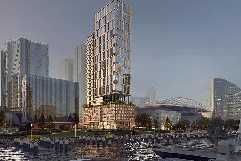
State approves major Docklands build-to-rent tower near Marvel Stadium
The Victorian Government has approved a major new build-to-rent tower in Docklands, giving the green light to a 554-home rental project at 699 La Trobe St in another sign of the precinct’s growing role in Melbourne’s expanding BTR market.
Read More
From one café client to 60 brands: The growth of Born Social
Tram bridge to E-Gate still possible despite West Gate Tunnel fears

 Download the Latest Edition