Understanding our geography

“When Europeans came here, they had a particular view of what the landscape was about. Part of that view was that swamps were of no particular value or, more accurately, that they were a source of disease.”
On July 23, Dr Gary Presland spoke in Docklands about the area’s geography, both pre- and post- colonisation. The Docklands swamp epitomises the differences.
“If you were to look at a map of Melbourne 30 years after settlement the Melbourne swamp was just the biggest of many swamps in the general area. They were thought of as being areas to avoid,” Dr Presland said.
“In a completely contrary view, the Aboriginal people looked upon them as being highly productive places.”
Aboriginal people could camp in these areas for longer than usual and could make use of the resources in them – both food and plant material.
“People constructed little floating rafts they could use to pick up roots and float them back. There were plants growing in these wetlands that provided medicines for them.”
“For Aboriginal people they were a boon.”
Dr Presland said the people of the Woiwurrung language group, the Wurundjeri people of the Kulin Nation that stretches to the Murray River, would gather in the Docklands area to enact business.
“They needed places like the wetlands in order to provide resources for people to be able to gather,” he said.
“About a couple of times a year large numbers of people would gather. They’d come up from Geelong, from the other side of the dividing range, from the Mornington Peninsula, and other places.”
“They’d all camp in traditional areas for those groups to camp in around the wetlands, and for a couple of weeks be in those areas enacting business – contracting marriages, deals, catching up on things happening in different areas.”
But since then, the actual geography of Docklands has been altered. Dr Presland said he became aware of those changes while working as an archaeologist for the state government in the 1980s.
“The area of Docklands is an important part of showing what people thought of the landscapes and how they altered it,” he said.
“There was a big problem in Melbourne in that the town itself was something like seven kilometres up the river from the bay.”
“In the 1870s people started thinking about having a canal, and the river itself was narrow and titled.”
“They decided the river would be widened and the docks would be built close to what at that time was Spencer St railway station.”
Related Articles

Immersive Melbourne festival to return in 2024
Now or Never, the new festival celebrating art, sound, and technology, which had a significant presence in Docklands during its in inaugural year in 2023, will return to Melbourne this winter.
Read More
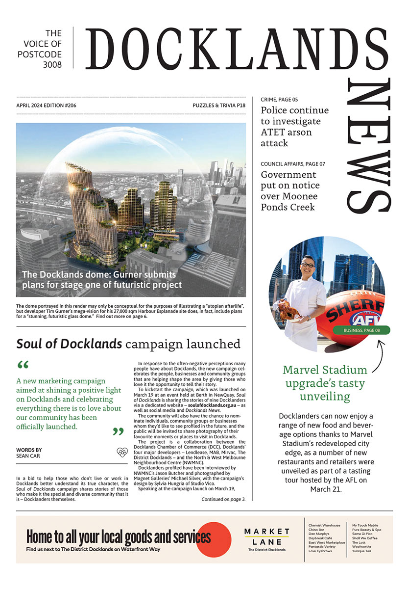
Soul of Docklands campaign launched
A new marketing campaign aimed at shining a positive light on Docklands and celebrating everything there is to love about our community has been officially launched.
Read More
New Docklands Primary campus opens at the District
A brand-new learning space campus for Docklands Primary School has opened at The District Docklands shopping centre, providing an environment for students to thrive.
Read More
New plans for Australia’s largest built-to-rent development in Docklands

E-scooter trial extended for the third time
 Download the Latest Edition