Design puts Docklands on the map

By Bethany Williams
Docklands’ significant architectural sites are the subject of a new bicycle route map.
Architecture firm Elenberg Fraser have mapped a bicycle route around Docklands, which visits 18 architectural sites in the area.
The bicycle route starts and ends at Southern Cross station on Spencer St. This site was seen as the natural starting point for the Docklands area.
Other sites visited along the route include NewQuay Promenade, Webb Bridge and the Mission to Seafarers building.
Graduate Elenberg Fraser architect Jansen Aui, who worked on the mapping project, said the bicycle route was a way of introducing people to the “eclectic quality of design” in the area that not many are aware of.
“The route will give people an idea of the diversity of design in Docklands,” Mr Aui said.
By following the route on foot or by bike, it is hoped that locals and visitors will gain insight into the variety of design, which can be found in the area.
It is estimated that the route will take around half an hour to cycle and between 45 minutes to an hour to walk.
The map is part of a project called Mapping the ‘Burbs, which featured in last month’s State of Design festival. The project ties in with the festival theme “design that moves”.
Mapping the ‘Burbs is an initiative of the Victorian chapter of the Australian Institute of Architects.
Mapping the ‘Burbs involved nine architectural firms located or with a connection to suburban or regional Victoria designing a cycling tour based around the significant pieces of architecture in their local area.
Other areas mapped in the project include Fitzroy, Kew, South Yarra/Prahan, St Kilda, Beaumaris, Hawthorn, Bendigo and Mornington.
The Docklands bicycle route can be found at http://www.architecture.com.au/emailnews/mapping-the-burbs/docs/map-burbs-docklands.pdf
For further information about Mapping the ‘Burbs see http://www.mappingtheburbs.com
Related Articles

Immersive Melbourne festival to return in 2024
Now or Never, the new festival celebrating art, sound, and technology, which had a significant presence in Docklands during its in inaugural year in 2023, will return to Melbourne this winter.
Read More
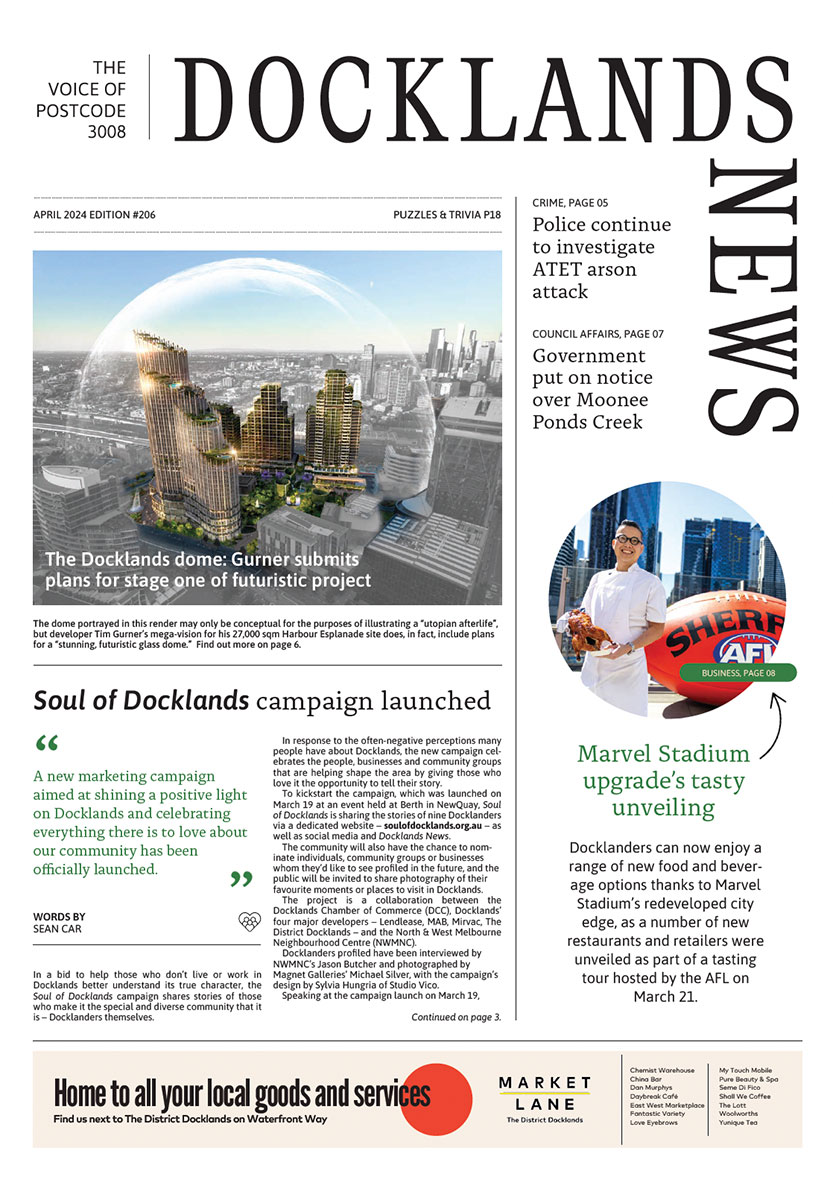
Soul of Docklands campaign launched
A new marketing campaign aimed at shining a positive light on Docklands and celebrating everything there is to love about our community has been officially launched.
Read More
New Docklands Primary campus opens at the District
A brand-new learning space campus for Docklands Primary School has opened at The District Docklands shopping centre, providing an environment for students to thrive.
Read More
New park to revitalise historic maritime precinct in Docklands

New plans for Australia’s largest built-to-rent development in Docklands
 Download the Latest Edition