How about a map?

25th February, 2010
How about a map?
I enjoy reading Docklands News, but get confused as to where all the different locations are, for example NewQuay, South Wharf, Waterfront City, Yarra’s Edge, Harbour Town, as well as the location of the community garden and the various streets such as St Mangos Lane.
Would it not be possible to include a small map in each edition to help those who don’t necessarily live in the area? There seem to be new streets opening up all the time.
Max

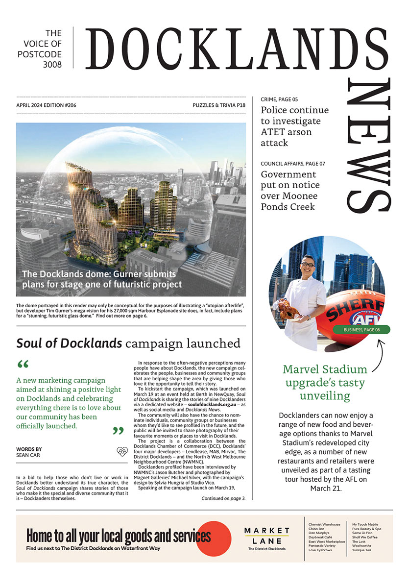
New park to revitalise historic maritime precinct in Docklands
April 11th, 2024 - Brendan Rees

New plans for Australia’s largest built-to-rent development in Docklands
April 10th, 2024 - Brendan Rees
Subscribe to all the news
Join Our Facebook Group
 Download the Latest Edition