Mapping from the Star

On June 19, the Melbourne Map team took a flight on the Melbourne Star to view the city from new angles.
The (new) Melbourne Map project is the re-invigorated version of the original project completed in 1990.
Research for the new project began in 2014. While originally the team wanted to use modern technology to overlay new buildings onto the old map, they discovered too much had changed and decided to start a new map.
Their reference material primarily comes from online mapping programs, but images are often out of date, especially with the speed at which new buildings are constructed in the city.
They were excited to ride the Melbourne Star and see the city from new angles and views.
New additions to the map include Docklands, Federation Square, Southbank and northern and western suburbs like Newport and Footscray.
Currently, illustration of Southern Cross Station has just been completed, and the team is hoping to complete the black-and-white illustration by mid-2018 and then continue to a coloured print.
Related Articles

Immersive Melbourne festival to return in 2024
Now or Never, the new festival celebrating art, sound, and technology, which had a significant presence in Docklands during its in inaugural year in 2023, will return to Melbourne this winter.
Read More
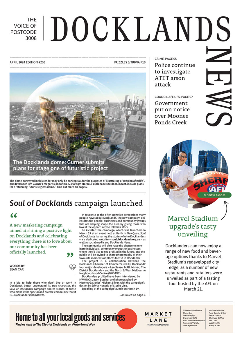
Soul of Docklands campaign launched
A new marketing campaign aimed at shining a positive light on Docklands and celebrating everything there is to love about our community has been officially launched.
Read More
New Docklands Primary campus opens at the District
A brand-new learning space campus for Docklands Primary School has opened at The District Docklands shopping centre, providing an environment for students to thrive.
Read More
New park to revitalise historic maritime precinct in Docklands

New plans for Australia’s largest built-to-rent development in Docklands
 Download the Latest Edition